
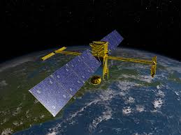
SWOT Satellite:
NASA has developed a new map of the ocean floor by using satellite data from SWOT Satellite.
- The Surface Water and Ocean Topography (SWOT) satellite was launched in 2022.
- It is a joint mission of NASA and CNES (French Space Agency).
- Satellite will collect detailed measurements of how water bodies on Earth change over time.
- It uses a specialised instrument called the Ka-band Radar Interferometer (KaRIn) to measure the height, width, and elevation of surface water bodies such as rivers, lakes, reservoirs, and oceans.
- SWOT offers high spatial resolution by bouncing microwaves off water surfaces and calculating return time, allowing dynamic water movement tracking.
- The satellite covers over 55% of large-scale global floods during their lifecycle through frequent Earth orbits.
- The satellite circles Earth and can scan about 90 per cent of the planet every 21 days
- It is equipped to observe the entire length of nearly all rivers wider than 330 feet and more than 1 million lakes and reservoirs larger than 5 acres.
- It will precisely measure fine differences in surface elevations around smaller currents and eddies, where much the oceans’ drawdown of heat and carbon is believed to occur.


