
Today’s Current Affairs: 26th Oct 2026 for UPSC IAS exams, State PSC exams, SSC CGL, State SSC, RRB, Railways, Banking Exam & IBPS, etc
Table of Contents
Fund for Responding to Loss and Damage:

The Fund for Responding to Loss and Damage (FRLD) has provisionally set aside $21.6 million for Nepal’s August 2026 floods, marking its first response to a specific disaster.
- Fund for Responding to Loss and Damage (FRLD) is an international climate-finance fund set up to help developing countries that are particularly vulnerable to climate change respond to economic and non-economic losses, including from extreme weather and slow-onset events.
- It operates under the financial mechanism of the UN Framework Convention on Climate Change (UNFCCC).
- It was established at the 27th Conference of the Parties (COP 27) to the UNFCCC in Sharm el-Sheikh, Egypt, in 2022 and operationalised at COP28 in Dubai, United Arab Emirates, in 2023.
- A Board of 26 members was constituted in 2023, and subsequently, the Philippines was selected as the host of the Board in 2024, while the World Bank was selected to host the Secretariat, and as the Fund Trustee.
- The Board of the FRLD consists of members from Parties to the UNFCCC and Paris Agreement, with members from developed and developing country
- By financing recovery initiatives from climate-related losses and damage, the Fund empowers communities to rebuild and adapt.
- It strives for country-led, locally driven solutions, ensuring interventions are aligned to country needs, priorities, and contexts.
What is the SAMHiTA Project?

India and Sri Lanka are strengthening their cultural cooperation through the preservation of their shared Buddhist heritage, with the launch of the SAMHiTA Project at Colombo’s Gangaramaya Temple.
- The SAMHiTA (South Asian Manuscript Histories and Textual Archive) Project is an initiative to create a relational database and digital archive of Indian and broadly South Asian manuscripts housed in libraries, archives, and other repositories outside India, through collaboration with institutional partners.
- The word ‘samhita’ in Sanskrit means ‘collection’ or ‘compilation’. SAMHiTA’s goal is to consolidate information dispersed across institutions on an online platform accessible to all.
- The information collected will be shared on PANDiT: Prosopographical Database of Indic Texts and Records, a database on South Asian intellectual history.
- The initiative is being undertaken by the India International Centre in New Delhi, with grant assistance from the Government of India and is supported by the Ministry of External Affairs (MEA).
- It aims to digitise ancient manuscripts and preserve their historical, religious, and cultural knowledge for future generations.
- It is the first attempt to bring together repositories from outside India and South Asia on a common platform.
Bonin Islands:
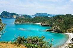
A magnitude 6.5 earthquake recently struck the Bonin Islands region of Japan.
- The Bonin Islands, also known as the Ogasawara Islands, are volcanic islands and islets in the central Pacific Ocean in the southeast of Japan.
- The islands command a strategic position astride the Pacific approaches to East Asia.
- The largest and principal island is Chichi (formerly Peel Island), the site of Omura, the capital of the group, and Futami-ko (Port Lloyd), the chief harbor.
- Bonin flying fox: A threatened fruit bat and the only endemic mammal of the Ogasawara Islands.
- They have been dubbed the “Galapagos of the Orient” due to the presence of many flora and fauna species that have evolved there independently.
- The Ogasawara Islands were added to UNESCO’s list of World Natural Heritage sites in July 2011.
Two New Plant Species : Identified

Two new plant species named Ophiorrhiza shidiensis and Ophiorrhiza pemae identified in Arunachal Pradesh’s Changlang district.
Ophiorrhiza shidiensis and Ophiorrhiza pemae:
- They are two new plant species.
- They were discovered in Arunachal Pradesh’s Changlang district.
- They belong to the Rubiaceae family.
- The Rubiaceae are a family of flowering plants, commonly known as the coffee, madder, or bedstraw family.
- Ophiorrhiza shidiensis is an erect, perennial herb that can grow up to one metre tall.
- It has pale green leaves on their undersides and tubular flowers that are white at the base, pale pink in the middle, and rose-pink towards the mouth.
- The species is named after “Shidi”, the traditional name for Gandhigram used by the Lisu (Yobin) community, referring to the locality where it was collected.
- Ophiorrhiza pemae is closely related to Ophiorrhiza himadrica but differs in several morphological characteristics, including its taller growth, larger leaves, distinctive leaf margins, and light pink to purplish flowers.
Lake Untersee:
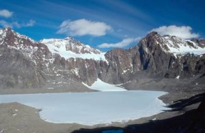
Glacial flood caused Lake Untersee to rise by two metres after a neighbouring lake released 17.5 million cubic metres of water.
- Lake Untersee, meaning “lower lake” in German, is a uniquely isolated freshwater lake in Antarctica.
- It is one of Antarctica’s largest and deepest surface lakes.
- Despite being a surface lake, it remains frozen throughout the year.
- The lake is fed from seasonal meltwater draining from the edges of the nearby Anuchin Glacier, which flows south from the Gruber Mountains.
- It is known for its distinctive water chemistry.
- Its ice-covered waters contain high levels of dissolved oxygen, very low levels of dissolved carbon dioxide, and a strongly alkaline, or basic, pH.
- It is one of the only perennially frozen lakes with a community of large, conical stromatolites.
- Stromatolites are layered microbial reef structures formed by communities of photosynthetic microbes, mainly cyanobacteria.
- The lake’s largest creatures are tardigrades—microscopic “water bear” invertebrates known for their ability to survive in extreme environments.
- Although Lake Unter-See appears stable, scientists have observed occasional changes. During fieldwork in 2019, researchers noticed that the lake’s water levels had risen.
What is China Zorrilla?
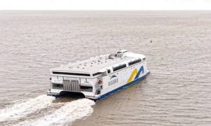
The world’s largest battery-electric vessel, China Zorilla, recently entered commercial service after completing its maiden trip between Buenos Aires, Argentina, and Colonia, Uruguay.
- China Zorrilla is the world’s largest battery-electric vessel.
- Previously known as Incat Hull 096, it was built by Australian shipbuilding company Incat Tasmania for South American ferry operator Buquebus.
- It is named after China Zorrilla, the celebrated Uruguayan actress and theatre personality.
- It is sailing under the flag of Uruguay.
- The energy system exceeds 40 MWh, with more than 250 metric tons of batteries.
- The system propels 8 electric motors connected to waterjets, giving it a speed of 25 knots.
- The vessel covers the 55-60 km route in 90 minutes, eliminating vibrations, toxic gases, and carbon emissions, while making the journey comfortable for passengers and harmless for the environment.
Advanced Emergency Braking System:
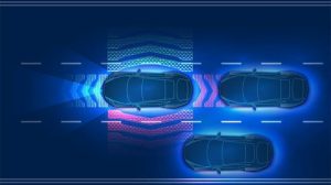
The Ministry of Road Transport and Highways (MoRTH) recently proposed making Advanced Emergency Braking Systems (AEBS) mandatory for all new car models from October 1, 2030, to help reduce road accidents.
- AEBS is an active vehicle safety technology designed to prevent collisions or reduce their severity.
- It is a combination of braking and sensor technology integrated into automobiles to recognise and prevent crashes.
- The system continuously monitors the road ahead, warns the driver when it detects a potential collision with another vehicle, pedestrian, or cyclist, and automatically applies the brakes if the driver fails to respond in time.
- AEBS is a key feature of Advanced Driver Assistance Systems (ADAS), a collection of more than 100 electronic technologies designed to improve road safety.
- AEBS operates continuously while a vehicle is moving.
- It uses a combination of radar sensors, cameras, or Light Detection and Ranging (LiDAR) technology, typically mounted near the front bumper or windscreen, to assess the distance from obstacles, their relative speed, and the time remaining before a potential collision.
- The system generally works in three stages:
- Warning stage: When the system detects an obstacle approaching rapidly and calculates that a collision is imminent, it issues an audio-visual alert, such as a dashboard warning light and a beeping sound, prompting the driver to brake.
- Partial or pre-braking stage: If the driver does not respond, the system may apply a brief, sharp brake pulse as a warning and pre-charge the braking system to maximise stopping power.
- Full emergency braking stage: If the driver still fails to take action and a collision is imminent, AEBS automatically applies maximum braking force.
- AEBS can reduce the impact of various crashes, including head-on, rear-end, right-turn, and pedestrian collisions.
- Countries Adopted AEBS:
- European Union
- Japan
- United States
- United Kingdom
- China
Girdling: In News
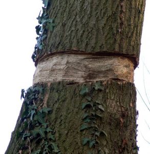
In an attempt to save over 500 trees, which were girdled allegedly by encroachers in Karka village deep inside the Udanti Sitanadi Tiger Reserve (USTR) recently, the Chhattisgarh forest department is seeking expert help – in the form of a “surgery” or bridge-grafting technique.
- Girdling is a commonly used habitat and forest management technique that deadens a tree without felling it for a specific purpose.
- Girdling involves the removal of bark and cambium from the target tree using continuous and connected cuts that completely encircle the entire tree.
- It destroys the cambium so no growth can occur and disrupts the flow of water and nutrients in the tree.
- As a result, roots are starved of nutrients, and the plant cannot grow more stems and foliage.
- Girdling is often used to control or eradicate large woody species where physical removal of woody biomass would be undesirable, unpopular, or cost prohibitive.
- This technique generally has a low impact on cultural resources, erosion, and surrounding habitat because it is highly selective and does not disturb soil.
Cambium:
- It is a layer of actively dividing cells between xylem (wood) and phloem (bast) tissues that is responsible for the secondary growth of stems and roots.
- In secondary growth, a plant grows wider. Contrast this to primary growth, in which a plant grows taller.
- The cambium originates from undifferentiated cells that have retained their embryonic capacity for continued growth and differentiation.
- A cambium may also form within callus tissues—masses of cells that grow over the injured surface of a wound, leading to healing.
- In a typical woody stem, the arrangement from outside to inside is:
- Bark → Phloem → Vascular cambium → Xylem → Inner stem
Bridge-Grafting:
- A bridge graft is an example of a repair graft.
- It is done to rescue established trees that have been girdled by mechanical damage or animals.
- Bridge-grafting consists of connecting the cambium layers above and below the girdled area.
- This process restores the flow of carbohydrates from the leaves down to the roots, thereby allowing the tree to continue its normal life
- The connection or bridge is usually made with scions (Bridge Wood). Scions are taken from dormant one-year-old stems.
What is the Filin Missile?
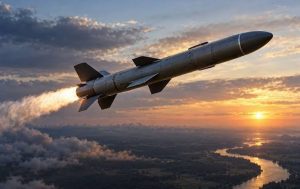
Ukraine’s military intelligence agency, HUR, revealed details of Russia’s reported Filin cruise missile recently, releasing a 3D model and information about its components and onboard electronic systems.
- Filin Missile s a low-cost, ground-launched, jet-powered cruise missile developed by Russia.
- The missile is produced by NPO Molniya, part of Russia’s Tactical Missiles Corporation.
- It features carbon fiber and glass fiber reinforced composite materials in its fuselage, and various structural components are manufactured using 3D printing
- The missile is launched from a ground-based launcher using a solid-propellant booster before its main engine takes over. The missile uses an R500 turbojet engine.
- It can reach a top speed of 800 km/hr and has a range of up to 1,200 kilometers.
- It is designed to fly at extremely low altitudes but can also climb to approximately 6 kilometers.
- Navigation is provided by a Chinese-made inertial navigation system together with a 16-channel Kometa satellite navigation module.
India’s Defence Exports to Europe:

India has reportedly emerged as Europe’s third-largest arms exporter, driven by rising ammunition demand under the ReArm Europe initiative, according to Defence Secretary.
- India’s defence exports have reached a record ₹38,424 crore, reflecting its expanding indigenous manufacturing capabilities
- India’s growing supply of ammunition, artillery shells, small arms, protective equipment and defence components to European countries, supported by indigenous manufacturing and expanding strategic partnerships.
- Aim is to establish India as a global defence manufacturing and export hub, strengthen strategic partnerships, promote Aatmanirbharta, and enhance technological sovereignty through indigenous production.
Key Findings:
- According to the Defence Secretary, India has emerged as Europe’s third-largest arms exporter, driven by rising demand for artillery shells and ammunition under ReArm Europe.
- India’s defence exports reached an all-time high of ₹38,424 crore, with Indian defence products now reaching over 80 countries worldwide.
- India’s defence ecosystem comprises 16 major public-sector companies, nearly 840 large and medium private firms, and 17,000 small enterprises, including startups.
- The government prioritises Indian Designed, Developed and Manufactured (IDDM) equipment, targeting approximately 75% of annual defence capital expenditure for domestic procurement.
- India is reducing dependence on traditional suppliers while exploring India–Europe defence joint ventures, enabling participation in European procurement programmes and technology partnerships.
The Land Warfare Doctrine 2026:
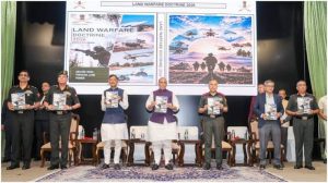
Defence Minister Rajnath Singh released the Indian Army’s updated Land Warfare Doctrine 2026 at the Army Commanders’ Conference in New Delhi.
- The Land Warfare Doctrine is afoundational strategic document issued by the Indian Army outlining authoritative operational principles, organizational concepts, force-structuring priorities, and warfare tenets to guide military planning and execution across the full spectrum of modern conflict. It supersedes the previous Land Warfare Doctrine released in December 2018.
- Aim is to modernise the Indian Army through multi-domain operations, emerging technologies, lessons from recent conflicts and Aatmanirbharta, enhancing operational agility and combat readiness.
Key Features of the Doctrine:
- Multi-Domain Operations (MDO) Integration: Integrates land, air, maritime, cyber, space and electronic warfare capabilities into coordinated operations, retaining land power’s central role in securing territorial objectives.
- AI and Autonomous Systems: Promotes artificial intelligence, advanced analytics, loitering munitions and autonomous strike platforms, supported by a three-level AI training programme for military officers.
- Drone Adoption and Manned-Unmanned Teaming (MUM-T): Makes drone operations and counter-UAS capabilities essential military skills, integrating autonomous systems with human combat teams to minimise casualties.
- Lessons from Recent Conflicts: Incorporates operational lessons from the eastern Ladakh standoff and Operation Sindoor, emphasising tactical agility, precision strikes, decentralised command and rapid adaptation.
- Operational Flexibility: Empowers field commanders to adapt tactics across high-altitude, jungle and desert environments, maintaining operational effectiveness despite electronic jamming and communication disruptions.
- Aatmanirbharta andWhole-of-Nation Approach: Prioritises indigenous defence manufacturing and integrates civilian infrastructure, industry and academia into military preparedness, strengthening technological self-reliance and national security.
- Long-Term Strategic Planning: Aligns modernisation with Defence Forces Vision 2047, emphasising sustained indigenisation, manpower optimisation, greater female officer participation and long-term capability development.
The NVS-03 Satellite:
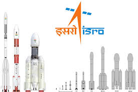
The Indian Space Research Organisation (ISRO) is slated to launch the NVS-03 navigation satellite on October 30, 2026, aboard a GSLV Mk II rocket from Sriharikota.
- It is the third satellite in ISRO’s second-generation NavIC (Navigation with Indian Constellation) series, designed to replace ageing first-generation IRNSS spacecraft, expand signal capabilities, and restore India’s independent satellite positioning coverage.
- Indian Space Research Organisation (ISRO): Develops and operates NavIC, with Space Applications Centre (SAC), Ahmedabad, developing navigation payloads and U.R. Rao Satellite Centre (URSC), Bengaluru, constructing satellite platforms.
- Conceived after the 1999 Kargil conflict, NavIC was designed as a seven-satellite regional navigation system, covering India and approximately 1,500 km beyond its borders.
- Faced multiple satellite failures involving rubidium atomic clocks, ageing spacecraft, IRNSS-1H launch failure and NVS-02 propulsion issues, weakening constellation reliability and navigation capabilities.
- By early 2026, only three satellites reportedly remained operational, below the four-satellite requirement for independent 3D positioning, severely restricting standalone navigation services.
- Aim is to restore NavIC’s independent positioning capability through at least four operational satellites, strengthen national navigation sovereignty, and expand compatibility with consumer electronic devices.
Key Features of NVS-03:
- Indigenous Rubidium Atomic Clocks: Incorporates SAC-developed atomic clocks for precise satellite timing, reducing dependence on imported components and addressing reliability problems experienced by earlier NavIC satellites.
- Tri-Band Navigation Signals: Supports L1, L5 and S-band signals, improving compatibility with smartphones, smartwatches and IoT devices while serving civilian and strategic navigation requirements.
- Extended 12-Year Lifespan: Built on ISRO’s I-2K satellite platform, with an approximate mass of 2,232 kg and a 12-year design life, exceeding earlier satellites.
- Dual-Tier Navigation Services:Provides an open Standard Positioning Service (SPS) for civilian users and an encrypted Restricted Service (RS) for authorised strategic and defence applications.
- Geosynchronous Orbit Architecture: Uses geostationary and inclined geosynchronous orbital positions to maintain favourable satellite visibility over India, strengthening regional navigation coverage and signal availability.