
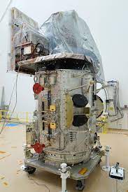
Landsat 9:
NASA has launched an earth monitoring satellite called Landsat 9 from Vandenberg Space Force Base in California. The satellite is a joint mission of NASA and the US Geological Survey (USGS).
- This satellite is referred to as NASA’s’ new eye in the sky’ that will help study climate change.
- Landsat-9 is the continuation of a series of Earth-observing spacecraft stretching back almost 50 years.
- The first Landsat satellite was launched in 1972 and since then, Landsat satellites have collected images of earth and helped understand how land usage has changed over the decades.
- In 2008, it was decided that all Landsat images will be free and publicly available and the policy has helped scores of researchers, farmers, policy analysts, glaciologists, and seismologists.
- Landsat images have been used to study the health of forests, coral reefs, monitor water quality and melting glaciers.
About Landsat 9:
- The Landsat 9 joins Landsat 8 that was launched in 2013 and the satellites together will collect images of Earth’s surface.
- It takes 8 days to capture the whole Earth.
- Landsat 9 carries instruments similar to the other Landsat satellites, but it is the most technologically advanced satellite of its generation.
- The instruments aboard Landsat 9 are the Operational Land Imager 2 (OLI-2) and the Thermal Infrared Sensor 2 (TIRS-2).
- OLI-2: It captures sunlight reflected off Earth’s surface and studies the visible, near-infrared, and short wave infrared portions of the spectrum.
- TIRS-2: It has a four-element refractive telescope and photosensitive detectors that capture thermal radiation and help study the Earth’s surface temperature.
- Along with the European Union’s Sentinel-2 satellites, the Landsat Satellite will provide better estimation of the extent of climate change.


