
Jhelum River : Water Level Fallen
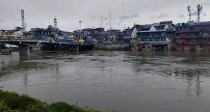
The water level of Jhelum and its tributaries have fallen drastically owing to dry weather conditions prevalent in Kashmir Valley.
- It is a river that flows in India and Pakistan.
- It is a tributary of the Indus River.
- The Jhelum (Vyeth in Kashmiri, Vetesta in Sanskrit and Hydaspes in Greek) is the main waterway of the Kashmir valley.
- It is the largest and most western of the five rivers of Punjab and passes through the Jhelum District in the North of Punjab province, Pakistan.
- It originates at the Verinag Spring at Anantnag, at the foot of the Pir Panjal range in the Kashmir Valley.
- It then flows via Srinagar and Wular Lake prior to entering Pakistan.
- The river makes a deep, narrow gorge on its way to Pakistan.
- It joins the Chenab River near Trimmu, Pakistan.
- It has a total length of about 725 km (450 mi).
- The largest tributary of the Jhelum is the Kishenganga (Neelum) River, which joins near Muzaffarabad and enters the Punjab province, Pakistan.
- Kunhar River is the second largest tributary of the river, which connects Pakistan-occupied Kashmir (PoK) and Pakistan on the Kohala Bridge of Kanghan Valley.


