
The NVS-03 Satellite:
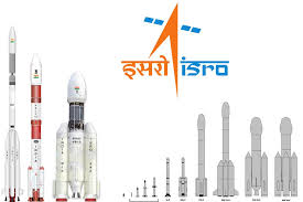
The Indian Space Research Organisation (ISRO) is slated to launch the NVS-03 navigation satellite on October 30, 2026, aboard a GSLV Mk II rocket from Sriharikota.
- It is the third satellite in ISRO’s second-generation NavIC (Navigation with Indian Constellation) series, designed to replace ageing first-generation IRNSS spacecraft, expand signal capabilities, and restore India’s independent satellite positioning coverage.
- Indian Space Research Organisation (ISRO): Develops and operates NavIC, with Space Applications Centre (SAC), Ahmedabad, developing navigation payloads and U.R. Rao Satellite Centre (URSC), Bengaluru, constructing satellite platforms.
- Conceived after the 1999 Kargil conflict, NavIC was designed as a seven-satellite regional navigation system, covering India and approximately 1,500 km beyond its borders.
- Faced multiple satellite failures involving rubidium atomic clocks, ageing spacecraft, IRNSS-1H launch failure and NVS-02 propulsion issues, weakening constellation reliability and navigation capabilities.
- By early 2026, only three satellites reportedly remained operational, below the four-satellite requirement for independent 3D positioning, severely restricting standalone navigation services.
- Aim is to restore NavIC’s independent positioning capability through at least four operational satellites, strengthen national navigation sovereignty, and expand compatibility with consumer electronic devices.
Key Features of NVS-03:
- Indigenous Rubidium Atomic Clocks: Incorporates SAC-developed atomic clocks for precise satellite timing, reducing dependence on imported components and addressing reliability problems experienced by earlier NavIC satellites.
- Tri-Band Navigation Signals: Supports L1, L5 and S-band signals, improving compatibility with smartphones, smartwatches and IoT devices while serving civilian and strategic navigation requirements.
- Extended 12-Year Lifespan: Built on ISRO’s I-2K satellite platform, with an approximate mass of 2,232 kg and a 12-year design life, exceeding earlier satellites.
- Dual-Tier Navigation Services:Provides an open Standard Positioning Service (SPS) for civilian users and an encrypted Restricted Service (RS) for authorised strategic and defence applications.
- Geosynchronous Orbit Architecture: Uses geostationary and inclined geosynchronous orbital positions to maintain favourable satellite visibility over India, strengthening regional navigation coverage and signal availability.