
Andaman Sea : Earthquake
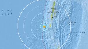
An earthquake of magnitude 5.2 struck the Andaman Sea recently.
- Andaman Sea is a semi-enclosed marginal sea in the northeastern Indian Ocean.
- It lies between the eastern coast of India and the Malay Peninsula, with Myanmar to the north and the Indonesian island of Sumatra to the south.
- The Bay of Bengal bounds the Andaman Sea to the west and the Strait of Malacca to the east.
- It is a complex geological region with a tectonically active plate boundary.
- It is part of the larger Sunda Plate, which the Indian Plate borders to the northwest and the Australian Plate to the southeast.
- The ongoing tectonic convergence between these plates has resulted in the formation of the Andaman Basin, characterized by undersea ridges, trenches, and faults.
- The most prominent geological feature in the region is the Andaman Trench, which is formed by the subduction of the Indian Plate beneath the Eurasian Plate.
- This tectonic activity has given rise to numerous earthquakes and volcanic eruptions in the region, making the Andaman Sea seismically active.
- It is home to extensive coral reef systems, sea grass meadows and mangrove forests, which provide critical habitats for a multitude of marine organisms.
- The Andaman Sea is also an important site for migratory birds, with several key stopover locations along the East Asian-Australasian Flyway.


