
Subsurface Water Ice Mapping (SWIM) Project : NASA
NASA’s Subsurface Water Ice Mapping (SWIM) project released its fourth set of maps.
- Subsurface Water Ice Mapping (SWIM) project aims to locate the best places to access water ice buried under the Martian surface.
- The recently released fourth set of maps is the most detailed and accurate since the project started in 2017.
- It is led by the Planetary Science Institute in Tucson, Arizona, and managed by NASA’s Jet Propulsion Laboratory in Southern California.
- The project uses data from several NASA missions, such as the Mars Reconnaissance Orbiter (MRO), the 2001 Mars Odyssey, and the defunct Mars Global Surveyor.
- SWIM used two higher-resolution cameras on MRO.
- The Context Camera data was used to improve the maps of the Northern Hemisphere.
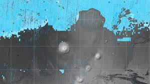
- For the first time, the HiRISE (High-Resolution Imaging Science Experiment) data was used to provide the most detailed view of the ice’s edge as close to the equator as possible.
- The first phase of the SWIM project, completed in 2019, focused on the northern hemisphere.
- The second phase, completed in 2020, includes the southern hemisphere.


