
Ravi River : Rise In Level
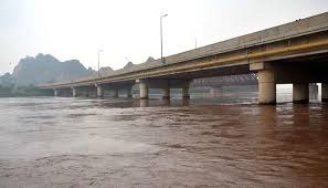
Continuous heavy rainfall in the hilly regions has led to a significant rise in water levels in the Ravi River recently.
- It is a river in northwestern India and northeastern Pakistan.
- It is one of the five tributaries of the Indus River that give Punjab (meaning “Five Rivers”) its name.
- It originates from the northern face of Rohtang Pass in Himachal Pradesh and flows through the junction formed by the BaraBang-Dhauladhar range of the Himalayas as two channels, namely Budhil and Tantgari.
- After joining, it flows through Himachal Pradesh, mainly the Chamba district, where it receives many tributaries.
- From there, it flows southwards through India, crossing through Punjab before crossing into Pakistan, where it finally merges with the Chenab River, a major tributary of the Indus River.
- It is 720 km
- The length of Ravi River in India is 320 km and has a catchment area of 14,442 sq.km
- The hydrology of the Ravi is controlled by spring snowmelt and the South Asian monsoon that brings heavy rains from June to September.
- It has several tributaries, including the Siul, Baira, and Ujh rivers.
- The Ravi River has several dams, primarily for hydropower generation and irrigation.
- The major ones include the Ranjit Sagar Dam (also known as Thein Dam) and the Chamera Dam complex (Chamera I, II, and III).
- The Indus Water Treaty of 1960 between India and Pakistan allocated the Ravi River, along with the Beas and Sutlej rivers, to India.


