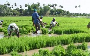
CROP (Comprehensive Remote Sensing Observation on Crop Progress):

The Indian Space Research Organisation (ISRO) has estimated that India’s wheat production from eight major wheat-producing states will reach 122.724 million tonnes as of March 31, 2025, by using advanced satellite-based remote sensing technologies.
- CROP stands for Comprehensive Remote Sensing Observation on Crop Progress.
- It is a semi-automated and scalable framework developed by the National Remote Sensing Centre (NRSC), a part of the Indian Space Research Organisation (ISRO).
- The primary objective of CROP is to enable near real-time monitoring of crop sowing, growth, and harvesting across different seasons, especially during the rabi season in India.
- CROP integrates data from multi-source remote sensing satellites, including:
- EOS-04 (RISAT-1A) – provides Synthetic Aperture Radar (SAR) data,
- EOS-06 (Oceansat-3) – provides optical remote sensing data, and
- Resourcesat-2A – used for high-resolution optical imaging of agricultural areas.
- It uses both Optical and SAR datasets to accurately monitor crop progress under varying weather and light conditions.


