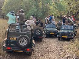
Ranthambore National Park : Safari Vehicles With (GPS) Trackers

The Ranthambore National Park administration plans to implement stringent monitoring of safari vehicles with Global Positioning System (GPS) trackers.
- Ranthambore National Park is located in the Sawai Madhopur district of southeastern Rajasthan.
- It lies at the junction of the Aravali and Vindhya hill ranges.
- It was the former hunting grounds of the Maharajas of Jaipur.
- It derives its name from the Ranthambore Fort situated within its precincts.
- It was on 1st November, 1980, that Ranthambore was declared a national park, while the forests located beside it were named Sawai Man Singh Sanctuary and Keladevi Sanctuary.
- It is characterised by rugged terrain with dense forests, lakes, and ancient ruins.
- The vegetation of the Ranthambhore is tropical dry deciduous and tropical thorn type due to its hilly track; water is confined to narrow valleys and some lakes.
- The Chambal River in the south and the Banas River in the north bound the park.
- There are several lakes in the park known as Padam Talab, Raj Bagh Talab, and Malik Talab.
- Its flagship species is Bengal tiger.


