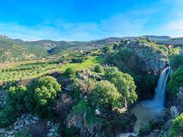
Golan Heights:

Israel recently agreed to double its population on the occupied Golan Heights.
- Golan Heights is a hilly area overlooking the upper Jordan River valley on the west.
- It is a Syrian territory occupied by Israel since 1967.
- The area’s name is from the biblical city of refuge Golan in Bashan.
- It is bounded by the Jordan River and the Sea of Galileeon the west, Mount Hermon on the north, the seasonal Wadi Al-Ruqqād River on the east, and the Yarmūk River on the south.
- It extends about 71 km from north to south and about 43 km from east to west at its widest point.
- It is roughly boat-shaped and has an area of 1,150 sq.km.
- The Syrian capital, Damascus, can be clearly seen from the top of the Golan Hills.
- It overlooks northern Israel’s Galilee region and the Sea of Galilee and dominates the route to Damascus on the Syrian-controlled side.
- Importantly, the Golan Heights shares a border with Jordan and Lebanon.
- The area is also a key source of water for an arid region. Rainwater from the Golan’s catchment feeds into the Jordan River.


