
Coastal Erosion:
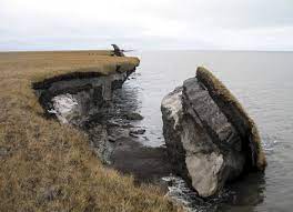
The Ministry of Earth Sciences informed the Lok Sabha that of the 6,907.18-km-long coastline of the Indian mainland, about 34% is under varying degrees of erosion, while 26% is of an accretional nature and the remaining 40% is in a stable state.
- The National Centre for Coastal Research (NCCR), Chennai, an attached office of the Ministry of Earth Sciences (MoES), is monitoring shoreline erosion since 1990 using remote sensing data and GIS mapping techniques.
- About 6,907.18 km long Indian coastline of mainland has been analysed from 1990 to 2018.
- In terms of percentage, West Bengal, located on the eastern coast of the country, with a 534.35-km-long coastline, suffered erosion along about 60.5% of the coast (323.07 km) over the period from 1990 to 2018.
- This is followed by Kerala on the west coast, which has 592.96 km of coastline and 46.4% of it (275.33 km) faced erosion.
- Tamil Nadu, with a long coastline of 991.47 km, recorded erosion along 42.7% of it (422.94 km).
- Gujarat, with the longest coastline of 1,945.6 km, recorded erosion along 27.06% (537.5 km) of it.
- In the Union Territory of Puducherry, with a 41.66-km-long coastline, about 56.2% of its coast (23.42 km) recorded erosion.
- Another organisation under the Ministry, the Indian National Centre for Ocean Information Services (INCOIS) has prepared and published an atlas of Coastal Vulnerability Index (CVI) maps for the entire coastline of India at a 1:100000 scale, the Ministry informed Parliament.


