
Enhanced Analysis Of Global Water Distribution:
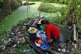
A recent analysis by scientists from the University of Bonn reveals that droughts worldwide are more widespread than previously recorded by the Gravity Recovery and Climate Experiment (GRACE) data from 2002-2017.
- The study combines GRACE satellite measurements with the WaterGAP hydrological model, improving the spatial resolution of water distribution maps from 300 km to 50 meters.
- The findings demonstrate that significant droughts, including those like the 2010 Amazon drought, extend over larger areas than satellite data alone indicates.
- This research has wider implications, aiding the understanding of global water balance, the causes of regional droughts and floods, and the influence of climate change on precipitation patterns.
- The analysis by University of Bonn scientists employs a combined approach of GRACE satellite data and the WaterGAP hydrological model.
- This method improves the spatial resolution of water distribution maps, revealing that major droughts span larger areas than previously thought.
- The study thus enhances our understanding of global drought extent and highlights the limitations of satellite data in capturing localized droughts.
- While GRACE satellites provided comprehensive data on Earth’s water reservoirs, they had a spatial resolution limitation of about 300 to 350 kilometers.
- This limitation rendered it feasible to make dependable assertions solely within regions encompassing approximately 100,000 square kilometers.
- In contrast, global hydrological models offer resolutions as fine as 50 kilometers or less, utilizing various meteorological measurements and factors.
- The researchers merged the GRACE satellite measurements with the WaterGAP hydrological model to create a global land water storage dataset.
- This innovative approach improved the resolution of water distribution maps to 50 meters from the previous 300 km, providing a more accurate representation of drought-affected areas.


