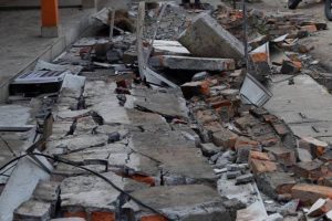
Assam Earthquake:

A powerful earthquake measuring 6.4 on the Richter Scale jolted Assam and other parts of Northeast.
- According to the National Centre for Seismology (NCS) report, the tremors have been attributed to Kopili Fault zone closer to Himalayan Frontal Thrust (HFT).
- NCS is the nodal agency of the Government of India for monitoring earthquake activity in the country. It comes under the Ministry of Earth Sciences.
Himalayan Frontal Thrust (HFT):
- HFT, also known as the Main Frontal Thrust (MFT), is a geological fault along the boundary of the Indian and Eurasian tectonic plates.
- Kopili Fault Zone:
- The Kopili fault zone is a 300 km long and 50 km wide lineament (linear feature) extending from the western part of Manipur up to the tri-junction of Bhutan, Arunachal Pradesh and Assam.
- The area is seismically very active falling in the highest Seismic Hazard zone V associated with collisional tectonics where Indian plate subducts beneath the Eurasian Plate.
- Subduction is a geological process in which one crustal plate is forced below the edge of another.
- Squeezed between the subduction and collision zones of the Himalayan belt and Sumatran belt, the North East is highly prone to earthquake occurrences.
- Fault:
- A fault is a fracture along which the blocks of crust on either side have moved relative to one another parallel to the fracture.
- When an earthquake occurs, the rock on one side of the fault slips with respect to the other.
- The fault surface can be vertical, horizontal, or at some angle to the surface of the earth.


